by Earl Smith
What an adventure! Having set a bikepacking excursion as one of my #2020goals, the TransVirginia Bike Route seemed like the perfect route. David Sadist (He goes by David Landis IRL – more on that later.) developed this 550-mile mostly unpaved route from Washington, DC to Damascus, VA. The route showcases the rugged beauty of Virginia’s Blue Ridge and offers a true adventure to an intrepid bikepacker – ever changing, often challenging, occasionally punishing, always beautiful.
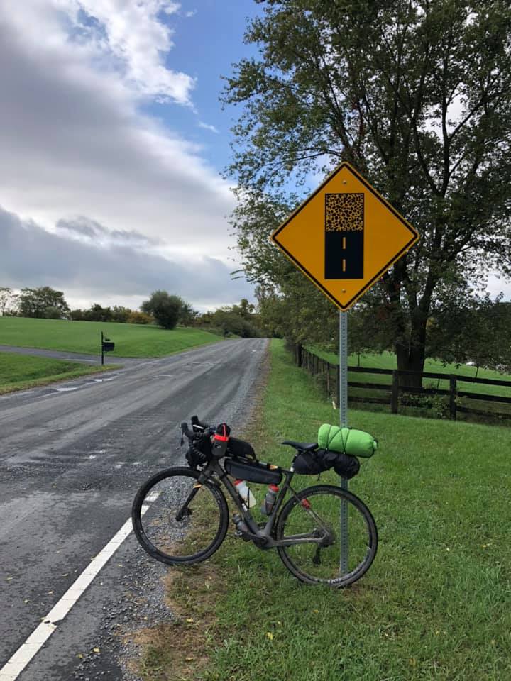
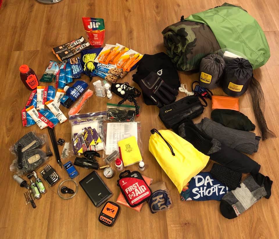
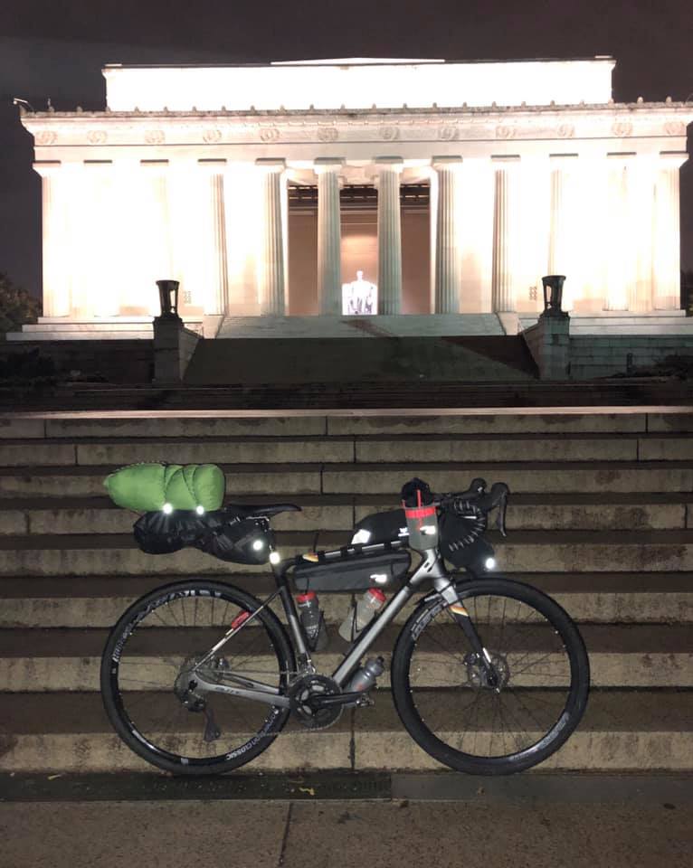
I postponed my departure several days to avoid the remnants of Hurricane Delta, but I awoke to drizzle in the early morning of Tuesday 10/13 nonetheless. After snapping the obligatory pic at the Lincoln Memorial, I rolled off full of anticipation. I made note of how the city street lights helped me fix the tire puncture still within sight of the Lincoln Memorial . Just as I wound up the diesel on the C&O Canal Towpath, I had to wrestle my fully-loaded bike (Yes, all that stuff in the pic fit.) over an enormous fallen tree. “Is the whole ride going to be like this?”, I asked. (spoiler alert: yes) Seeing the long-idle locks that allowed boats to move through the canal intrigued my engineering side and had me wondering what tomorrow’s innovators will think of our modern world. After a quick ride on White’s Ferry across the Potomac River and a jaunt through suburbia on the Washington & Old Dominion Trail, I found myself riding Loudoun County gravel roads – surprising considering their location in Northern Virginia. I crossed I-81 at Mile 105 and headed into the bicycling paradise of Virginia’s Blue Ridge I call home. The rocky Cedar Creek Trail had me pushing my loaded gravel bike for several miles, so I found the primitive camping at Little Stony Creek (Mile 140) to be the perfect location to hang my hammock for my very first night of bikepacking. (We’ll just call my trip planning marginal and leave it at that. )
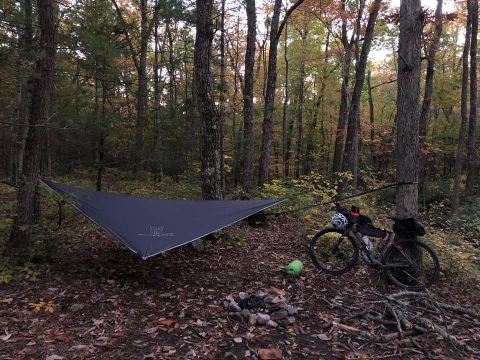
I had to do some maneuvering to wrap myself in a “space” blanket to block the strong winds that followed the hurricane. I felt quite snug as I clicked off my headlamp and closed my eyes. Then the bottom fell out…literally. It seems my butt had bumped the ground during my hammock gymnastics and ripped the fabric just enough for it to split the hammock in half. Now without “lodging” and many miles from anywhere or anyone, it would have been wise to send out the “come and get me” message on my Spot tracker. Of course, that’s not how I do things. I tied a series of knots in the ripped hammock fabric and managed to contort my body into the part of the hammock I could salvage, albeit without being wrapped up as well as I needed to be. The uncomfortable position had me constantly moving around and the relentless winds had me shivering all night. Not sleeping for even a minute gave me plenty of time to realize I would have to ride 170 miles over steep, rugged terrain to Covington the next day so I could sleep in a hotel. Packing up in the pre-dawn darkness, I began to dread the steep climb over the ridge – the first of many. This would be a challenging bikepacking excursion indeed.
Shivering uncontrollably in the Mathias Post Office lobby, I cursed the inaccurate weather forecast. I had riding clothing for the expectedly chilly autumn mornings, but I actually would’ve had to know it would be 35-degrees with howling winds on the other side of the ridge beforehand. Fortunately, it had warmed up and the winds died down by the time I hit the fearsome German River Road climb, and I began to enjoy the fall foliage splendor on display all around me, far more beautiful than anything humans could ever create. That took my mind off the punishment my legs endured as I struggled up the rocky grade. (Listen to the bikepacking advice that says a 1:1 low gear is NOT low enough.) The long, agonizing slog through the mud across a soggy Hall Spring Road had me actually looking forward to the steep climb up Dunkle Hollow Road, but not before viewing a magnificent display of autumn color on the descent down Route 33.
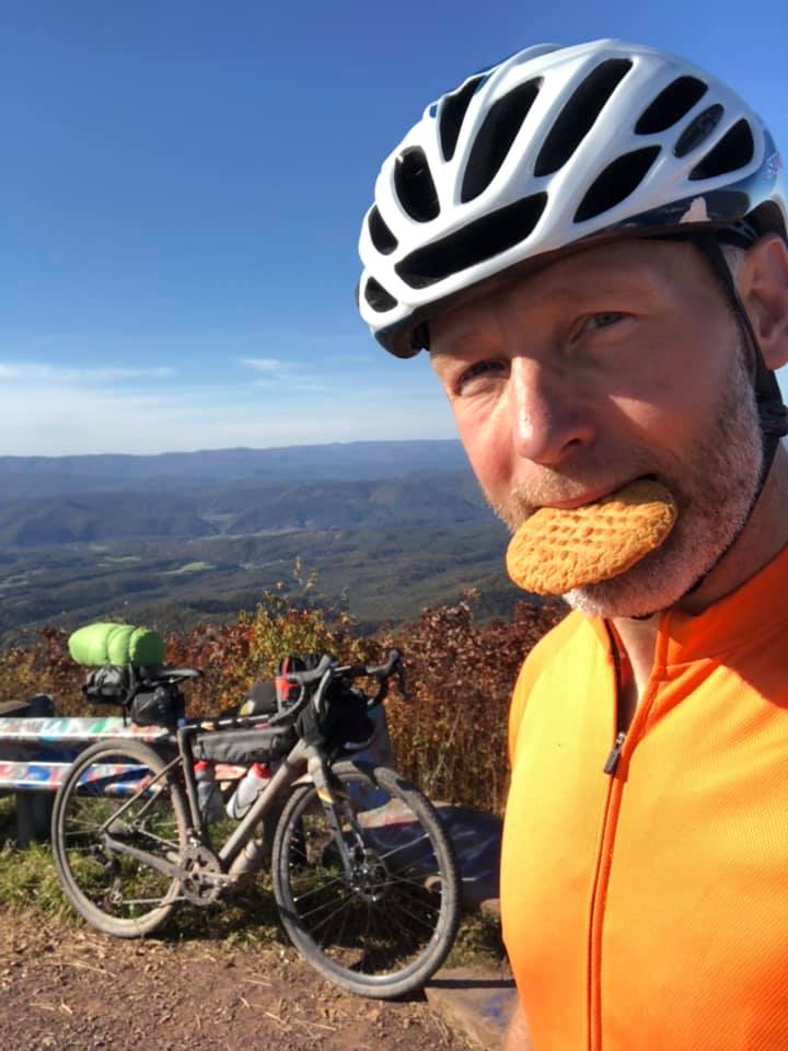
Snapping the pic on Reddish Knob, I realized the fall foliage already showed a hint of brown on the 4000’ peaks. (David Sadist sends you up several steep, rugged, hours-long climbs to the tops of said peaks. All views are stunning and well-earned.) Rolling into West Augusta just as the sun set, I realized it had taken a previously unimaginable 12 hours to ride the first 100 miles of the day. That didn’t trouble me – I couldn’t have ridden that brutal (but beautiful!) terrain any faster. My concern focused on the 70 miles I still had to ride at night. Rolling along the meandering gravel roads tracing the Cowpasture River, I marveled at how peaceful and rejuvenating riding through a starry night can be. The slow song of cold katydids complimented the sound of my tires grinding gravel as I made my way through Douthat State Park and up Dolly Ann Road outside Covington. My cold, weary face could only murmur single word answers as the hotel clerk got me checked in just before 3:00 a.m. I felt a little guilty sinking into a comfy bed on a bikepacking trip (for three seconds, maybe), but I desperately needed that two hours of deep sleep. Another long day awaited.
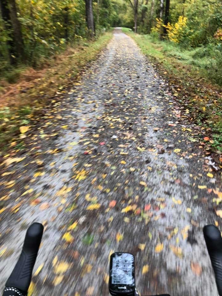
The long climb out of Covington had me shedding layers right away. The morning fog had burnt off, and I enjoyed the peaceful still autumn morning as I made my way toward the climb on the nice forest road up Potts Mountain…the first time. Yes, the route takes you back down and then back up a steep, rocky double-track “road” followed by a gnarly descent down a rutted, muddy double-track mess. Relaxing my grip on my brake levers at the bottom, I looked forward to making up some time across the valley toward the climb to Mountain Lake. Gusty headwinds abruptly replaced that idea with deep contemplation over how I’m able to create optimism so effectively while I’m riding but view most things in my real life through a skeptical pessimistic lens. Conclusion: I should ride even more! (Nobody saw that coming, I know. ) The chirping of chipmunks helped me keep pedaling cadence on the long climb up to Mountain Lake (now half full again), and I descended into Eggleston looking forward to my evening refueling stop at J&J Grocery outside Pulaski. I joked with the store owner about him having to do everything, including taking out the trash at his own store. He told me about his grandson in New Mexico who rides backcountry mountain bike trails. As I set out for the nighttime leg of Day 3, I found myself glad to be riding a gravel route instead of a backcountry mountain bike route where you might expect to climb near-vertical rock walls. Then I hit Alum Spring Road. I got passed by a snail as I struggled to turn the pedals over and keep my bikepacking rig crawling up over that loose, rocky wall of a “road”. By this point, I think David Sadist may have been feeling a little bad about beating up on naïve, novice bikepackers like myself, so he routed the TransVirginia Bike Route along the rails-to-trails (read: flat and smooth) New River Trail. Lights ablaze, I did my best impression of a locomotive for that 30+ miles, breaking cadence only occasionally to swerve around startled opossums and raccoons. Climbing out of the New River Valley in the dead of night, I questioned my decision to ride by the picnic pavilions along the New River Trail. With no “lodging” with me and rain in the forecast, I wanted to sleep on a picnic table under a pavilion that night. I also wanted to be within 80 miles of Damascus. I gambled that the tiny town of Cripple Creek (south of Wytheville) would have a church with a pavilion. Just one mile off route, I rolled up to Crockett’s Chapel Church at 3:00 a.m. I felt the 155 grueling miles I had ridden that day as I set up camp on the picnic table…just in time for the wind to pick up in front of the rain. Each time the wind-blown tree limb scraped across the pavilion roof, I became more aware there would be no sleep again tonight. I shut off my 6:00 a.m. alarm before it went off and rode away into the cool morning mist.
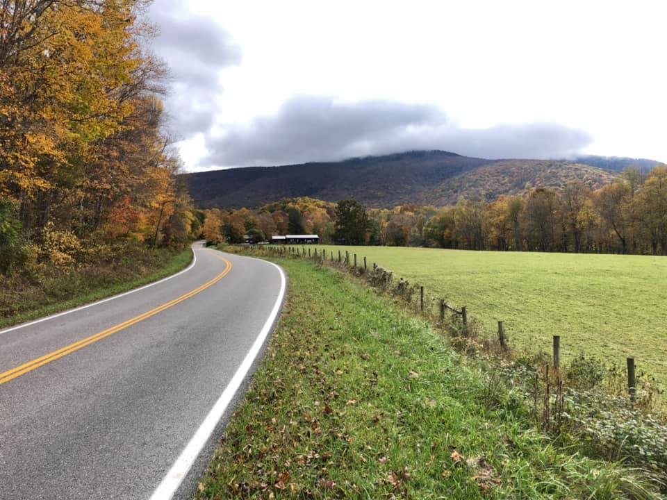
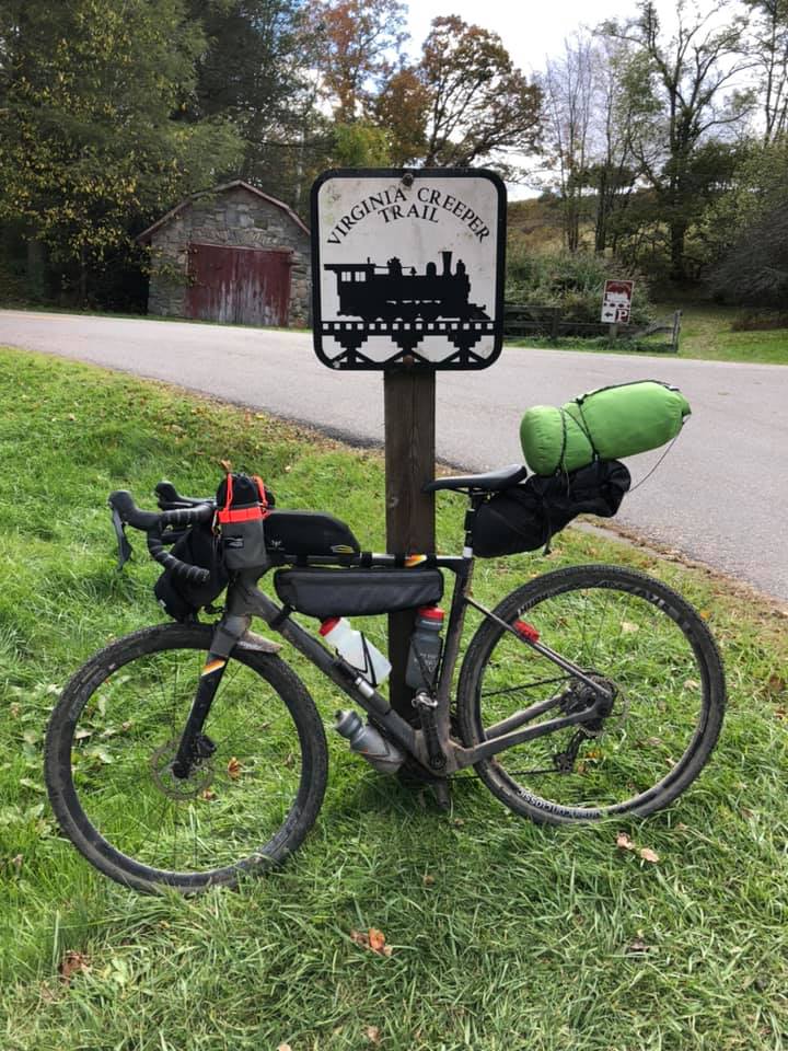
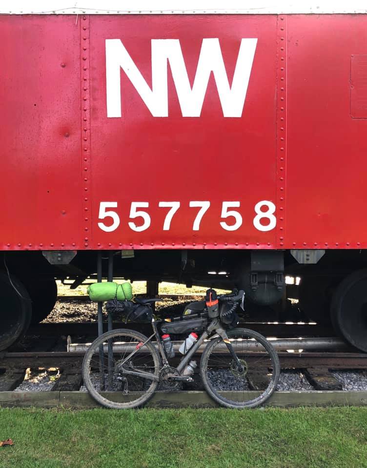
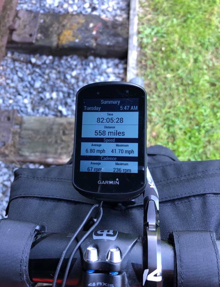
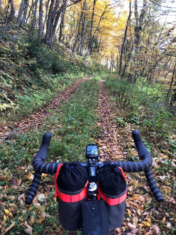
The climb out of Cripple Creek on C C Camp Road on the perfectly still autumn morning of Day 4 will be forever etched in my memory. I could actually hear the colorful leaves flutter to the ground as I pedaled seemingly-effortlessly up and over that beautiful, rugged ridge, fully immersed in shinrin-yoku (forest bathing). No photo could capture the overwhelming peace and happiness I felt in those moments. Fortunately, the TransVirginia Bike Route offers this scenario to bikepackers many times over, and I soon found myself again surrounded by true gravel riding bliss on the climb up Hurricane Road in the Grayson Highlands. Even the passing rain couldn’t dampen my spirits. As I rolled to a stop at the top of that last gravel climb, admittedly exhausted and anticipating the finish, I felt a slight sense of disappointment that this tremendous experience would be coming to an end soon. I stopped to snap a pic of the picturesque paved climb up to White Top – the final climb before descending into Damascus on the Virginia Creeper Trail. I experienced a flood of mixed emotions in that bittersweet moment when my bicycle wheels finally rolled to a stop at the red caboose. 558 miles, 82 hours after I embarked on my first bikepacking excursion, I had met the challenge, and I’ll be forever rewarded with memories of adventure.